
NEWS
WKP Gunung Sirung in Paradise Island
NQ News
Monday, January 11, 2021
WKP Gunung Sirung was established established in 2016, located in Pantar Island, Alor Regency, East Nusa Tenggara Province with resources potency of 152 MW. 1st Geothermal Power Plant with capacity 5 MW is targeted to operate in 2025. Of the total area of WKP (14,500 Ha), there are around 6,500 Ha of forest area, mostly protection forest.
Early survey and assessment of WKP Gunung Sirung is conducted by Geological Agency before 2015 and continued by PLN in 2017 through NewQuest Geotechnology in Preparation of Exploration Program and Development Plan Proposal project covering the following scopes:
- Conducting Remote Sensing data interpretation for determining geological "play" concept
- Review existing geological & geochemical data
- Reprocessing of existing geophysical data
- Integrated interpretation & conceptual model
- Potential resource calculation
- Planning of Exploration Program, Well Targeting, Basic Power Plant Preliminary Design, and Economic Analysis
- Report and presentation to Ministry of Energy and Mineral Resources.
In 2017, the Geological Agency drilled 2 gradient wells with a depth of 700 m, The WKP Gunung Sirung, Pantar Island is characterized by hot springs with temperatures of 37 to 99 0C, hot soils, and altered rock. Estimated reservoir temperature of 260oC which is included in the high temperature geothermal system.
In 2018, the government, in this case Ministry of Energy and Mineral Resources (KESDM), assigned PLN to manage this WKP. The challenge of developing Sirung Geothermal Power Plant (PLTP) is a small demand in Pantar island which makes investment cost per MW higher. Hope the Feed in Tariff (FiT) Formula can overcome the challenges of developing the PLTP Gunung Sirung.
Pantar is a group of islands located between Lembata Island and Alor Island (the central location of Alor Regency), the Pantar Islands has small islands including Batang Island, Lapang Island, Rusa Island, Kangge Island, Kura Island, Tereweng Island, Ternate Island and Buaya Island. Pantar Island area is 728 km² and there are several mountains: Mount Sirung (862 m), Mount Khulinggang, Mount Komawas and Mount Tuntuli.
Pantar Island is also blessed with various renewable energy sources, namely Geothermal Energy, Ocean Current, Wind and Solar. Currently, Pantar Island electricity with a load of less than 5 MW is generated by PLTD (Diesel) and PLTS (Solar PV).


Gravity Survey and Magnetotelluric Data Processing of Jailolo Geothermal Prospect Area, West Halmahera
NQ News, Monday, 11 April 2022

Press Release: NewQuest Geotechnology Anniversary Day - A Ten Years of Contributions
NQ News, Monday, 25 of October 2021

SPECIAL NQ 10 YEARS ANNIVERSARY DAY “Geothermal Technology Innovations: A Perspective from...
NQ News, Thursday, 21st of October 2021

Special NQ Training: “Magnetotelluric (MT) for Geothermal Exploration”
NQ News, Monday, 4 October 2021

Special NQ Training For Public Society: “Geothermal Energy: A Special Gift for Indonesia”
NQ News, Thursday, 30 September 2021

Review of Special NQ Academy Webinar #10: Technology & Innovation to Accomplish Geothermal...
NQ News, Thursday, 16 September 2021

NQ Ten Years Anniversary: Contributions for National Prosperity Through Continuous Innovations
NQ News, Tuesday, 1 September 2021

NQ Academy Webinar #10: Technology & Innovation to Accomplish Geothermal as Affordable Energy
NQ News, Tuesday, 1 September 2021


Review of NQ Academy Webinar #9: Steam Field Management: Problems and Troubleshootings
NQ News, Monday, 16 August 2021

NQ Academy Webinar #9: Steam Field Management: Problems and Troubleshooting
NQ News, Friday, 30 Juli, 2021

GEOTHERMAL MEDIUM TEMPERATURE RESOURCES IN MALAYSIA, THAILAND AND INDONESIA
NQ News, Wednesday, May 5, 2021

Review of NQ Academy Webinar #8: Lessons Learned from Geothermal Exploration in Muara Laboh
NQ News, Monday, May 3, 2021

NQ and IMT-GT Webinar on Exploration & Utilisation of Low-Medium Geothermal Resources...
NQ News, Friday, April 23, 2021

NQ Academy Webinar #8: Lessons Learned from Geothermal Exploration in Muara Laboh
NQ News, Wednesday, April 21, 2021

Review of NQ Academy Webinar #7: Geothermal Production Processes through Geochemical Interventions
NQ News, Thursday, April 1, 2021

NQ Academy Webinar #7: Optimization of Geothermal Production Processes through Geochemical Interventions for ...
NQ News, Thursday, March 25, 2021


Review of NQ Academy Webinar #6: From Large-Scale Tectonics to Field-Scale Geothermal Systems
NQ News, Wednesday, March 3, 2021

NQ Academy Webinar #6: From Large-Scale Tectonics to Field-Scale Geothermal System: Lessons Learned from Sumatra
Thursday, February 25, 2021

Review of NQ Academy Webinar #5: Final Preparation of Government Drilling Program
NQ News, Friday, February 5, 2021

WKP Cisolok Cisukarame: First WKP to drill in Government Drilling Program
NQ News, Tuesday, February 2, 2021


Review of NQ Academy Webinar #4: Geochemical Signatures over Volcanic Geothermal Systems
NQ News, Wednesday, December 23, 2020

NQ ACADEMY WEBINAR #4: Geochemical Signatures over Volcanic Geothermal Systems
NQ News, Wednesday, December 16, 2020


The Three Million Dollars Well: A Lesson Learned from Geothermal Drilling in Indonesia
NQ News, Monday December 7, 2020

NewQuest Geotechnology & North Tech Drilling Signed a Strategic Partnership Agreement
Press Release: Monday November 30, 2020

NQ ACADEMY WEBINAR #3: THE THREE MILLION DOLLAR WELL: A LESSON LEARNED FROM ...
NQ News, Thursday November 19, 2020

NQ SURVEY AND EXPLORATION IN MALAYSIA AND PROSPECTS FOR GEOTHERMAL DEVELOPMENT ...
NQ News, Monday November 16, 2020


WKP TANGKUBAN PERAHU, DEVELOPING GEOTHERMAL IN VOLCANO TOURISM LOCATIONS
NQ News, Monday October 26, 2020


"BEST GEOTHERMAL SERVICES COMPANY" AWARD FOR NEWQUEST GEOTECHNOLOGY
NQ News, Wednesday September 30, 2020

WKP ATADEI, A PARTNERSHIP OPPORTUNITIES ON PLN’s GEOTHERMAL WORKING AREA (WKP)
NQ News, Monday September 28, 2020

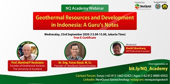
DR. YUNUS DAUD LAUNCH NQ ACADEMY ON THE 1ST NQ ACADEMY WEBINAR EVENT
NQ News, Friday September 25, 2020


NewQuest footprint in Blawan - Ijen WKP, First Discovery of hidden geothermal in Indonesia
NQ News, Friday August 21, 2020


RI "Too Preoccupied" with Fossil Energy, Renewable Energy Should Be Accelerated
Friday, 3 February 2017
